
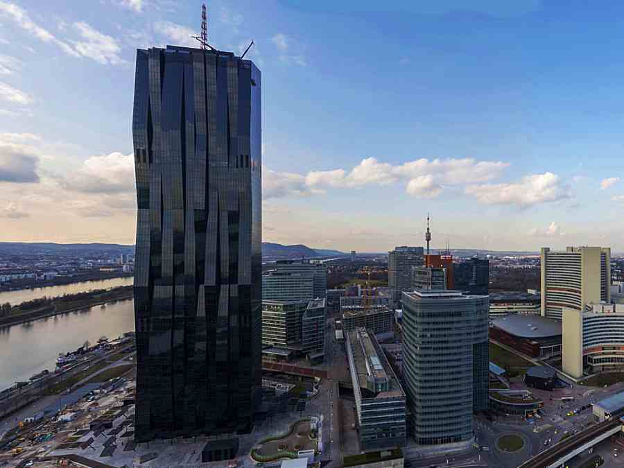
![]() The DC Tower in Vienna.
The DC Tower in Vienna.
Fri 22 December 2023:
The stability of dams, bridges and critical infrastructure can be monitored in the future with a new measurement system developed in Austria, the school said Thursday.
The system which was developed by Technical University (TU) in Graz, uses navigation satellites to measure changes with millimeter precision from a distance of 20,000 kilometers (12,426 miles). The technology was tested at the DC Towers in Vienna.
DC Towers are three skyscrapers designed and partially completed by French architect Dominique Perrault in Vienna’s Donau City.
The first of the three buildings, DC Tower 1, was opened Feb. 26, 2014, and has become the tallest building and second-tallest structure in Austria.
DC Tower 2 is currently under construction and DC Tower 3 will be completed later.
TU Graz said the new system can be used to monitor the condition of buildings, statically and dynamically, at the same time.
The method uses antennas to measure slow deformations, such as changes in the congestion level, and dynamic changes, such as vibrations during an earthquake.
Previously available technologies used different methods for the measurements.
The new method enables measurements in poor weather conditions — meaning continuous monitoring can be guaranteed even in rain, snowfall, fog or storms.
“The high level of accuracy that we were able to achieve with the measurements in the InfraHealth project funded by the Austrian Research Promotion Agency (FFG) is almost unique,” project manager Caroline Schonberger said in the statement.
The technology uses local antennas in combination with publicly accessible GNSS signals from Galileo, GPS and GLONASS satellites.
The antennas are attached to measuring points on the structure, while another so-called reference antenna, is located relatively close by on a stable surface.
For static measurements, a fixed interval is used for the evaluation, which is always greater than one second.
The combination of all three GNSS systems at the DC Tower was also able to measure the foothills of the Nov. 9 earthquake in northern Italy, according to the statement.
-Source: AA
______________________________________________________________
FOLLOW INDEPENDENT PRESS:
WhatsApp CHANNEL
https://whatsapp.com/channel/0029VaAtNxX8fewmiFmN7N22
![]()
TWITTER (CLICK HERE)
https://twitter.com/IpIndependent
![]()
FACEBOOK (CLICK HERE)
https://web.facebook.com/ipindependent
![]()
Think your friends would be interested? Share this story!