
Tue 29 August 2023:
China on Monday released the 2023 edition of its “standard map”, staking a claim over Arunachal Pradesh, Aksai Chin region, Taiwan and the disputed South China Sea, news agency PTI reported.
China’s official map, referred to as the 2023 edition, was introduced via the Ministry of Natural Resources’ standard map service website.
“This map is compiled based on the drawing method of national boundaries of China and various countries in the world,” state-run Global Times said in a post on X (formerly Twitter).
The 2023 edition of China's standard map was officially released on Monday and launched on the website of the standard map service hosted by the Ministry of Natural Resources. This map is compiled based on the drawing method of national boundaries of China and various countries… pic.twitter.com/bmtriz2Yqe
— Global Times (@globaltimesnews) August 28, 2023
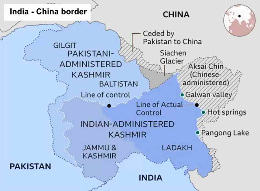
The map displayed by the Global Times showed Arunachal Pradesh, which China claims as South Tibet, and Aksai Chin occupied by it in the 1962 war, PTI reported. The map also incorporated Taiwan, which China claims as part of its territory though the island sees itself as sovereign nation, and the nine-dash line, claiming a large part of the South China Sea, according to the news agency.
Arunachal Pradesh and Aksai Chin, both areas that have long been subject to conflicting claims between China and India. Arunachal Pradesh, despite China’s assertions of it as South Tibet, has steadfastly remained an integral part of India. India has consistently reiterated this stance. India has repeatedly said that the state of Arunachal Pradesh has “always been” and will “always be” an integral part of the country, PTI reported.
Earlier this year in April, after China released a third set of namesin Chinese, Tibetan and Pinyin characters for Arunachal Pradesh, External Affairs Ministry spokesperson Arindam Bagchi had asserted, “Arunachal Pradesh has always been, and will always be an integral part of India.”
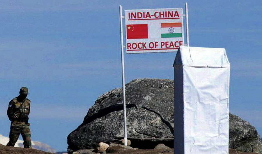
India and China share a border more than 3,440km (2,100 miles) long and have overlapping territorial claims. Their border patrols often bump into each other, resulting in occasional scuffles but both sides insist no bullet has been fired in four decades.
Their armies – two of the world’s largest – come face to face at many points. The poorly demarcated Line of Actual Control (LAC) separates the two sides. Rivers, lakes and snowcaps mean the line separating soldiers can shift and they often come close to confrontation.
History holds difficult lessons for India. It suffered a humiliating defeat during the 1962 border conflict with China. India says China occupies 38,000km of its territory. Several rounds of talks in the last three decades have failed to resolve the boundary issues.
China already controls the Aksai Chin area further east of Ladakh and this region, claimed by India, is strategically important for Beijing as it connects its Xinjiang province with western Tibet.
SOURCE: INDEPENDENT PRESS AND NEWS AGENCIES
______________________________________________________________
FOLLOW INDEPENDENT PRESS:
TWITTER (CLICK HERE)
https://twitter.com/IpIndependent
![]()
FACEBOOK (CLICK HERE)
https://web.facebook.com/ipindependent
![]()
Think your friends would be interested? Share this story!